The road that developed through the interactions of people and goods
The old Koshu-kaido Road runs through the Kai Region from the east to northwest about 205 km from Edo to Shimosuwa. Centering on 25 post stations built in the Kai Region, a great amount of people, goods, and information traveled back and forth, helping the post stations to grow and thrive. This journey traces the tradition and magnificent landscapes along the road.
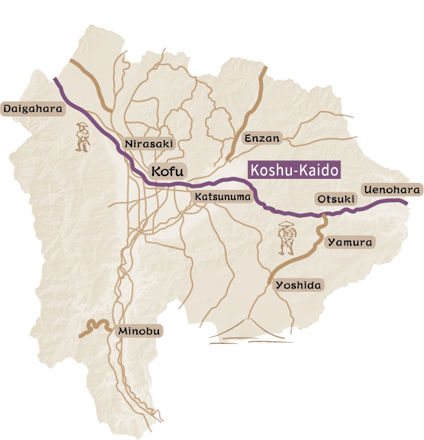
The old Koshu-kaido Road was one of the Five Highways (Gokai-do) developed by the Edo shogunate. About 205 km long, it connects Nihombashi in Edo to Shimosuwa-shuku along the Nakasen-do Road.
There were 45 post stations along the road. The Kai Region had 25 post stations along the old Koshu-kaido Road that were used by members of the Suwa Clan from the Takashima Domain, the Naito Clan from the Takato Domain, and the Hori Clan from the Ida Domain traveling to and from Edo to serve the Shogun (sankin-kotai). After the Kai Region came under the direct jurisdiction of the Edo shogunate, samurai guarding Kofu-jo Castle also used the post stations.
The old Koshu-kaido Road was first developed as an important means of deploying soldiers rapidly in times of need. Therefore, some roads were divided into two routes, and others featured sharp turns near the entrance of post stations and the east side of Kofu-jo Castle. These features were designed to prevent attacks by opponents that might try to enter post stations or castle towns by causing confusion or blocking the field of view.
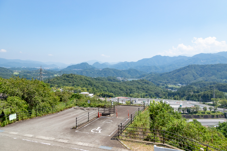
As peace reigned during the middle and late Edo Period, travelers and intellectuals interacted at post stations. The old Koshu-kaido Road also played an important role in the distribution of agricultural products to Edo from the Koshu and Shinshu Regions. Post stations along the road nurtured culture through interactions with Edo, including entertainment and art enjoyed by travelers, and this cultural heritage has been passed down to the present. Post towns also show us the history of cooperation, cooperation seen in the unique system of post stations functioning jointly with neighboring post stations called “aishuku” during times of financial difficulty, and in restoration work when flooding caused significant damage. Entering Kofu Basin beyond Sasago Pass, the most dangerous section along the old Koshu-kaido Road, visitors see unique landscapes of eight specialty fruits being cultivated in the Koshu Region, fruits such as grapes, peaches, and persimmons, and unique geographical features such as alluvial fans and river terraces, features that became the foundation for the spread of fruit growing.
There were 45 post stations along the road. The Kai Region had 25 post stations along the old Koshu-kaido Road that were used by members of the Suwa Clan from the Takashima Domain, the Naito Clan from the Takato Domain, and the Hori Clan from the Ida Domain traveling to and from Edo to serve the Shogun (sankin-kotai). After the Kai Region came under the direct jurisdiction of the Edo shogunate, samurai guarding Kofu-jo Castle also used the post stations.
The old Koshu-kaido Road was first developed as an important means of deploying soldiers rapidly in times of need. Therefore, some roads were divided into two routes, and others featured sharp turns near the entrance of post stations and the east side of Kofu-jo Castle. These features were designed to prevent attacks by opponents that might try to enter post stations or castle towns by causing confusion or blocking the field of view.
As peace reigned during the middle and late Edo Period, travelers and intellectuals interacted at post stations. The old Koshu-kaido Road also played an important role in the distribution of agricultural products to Edo from the Koshu and Shinshu Regions. Post stations along the road nurtured culture through interactions with Edo, including entertainment and art enjoyed by travelers, and this cultural heritage has been passed down to the present. Post towns also show us the history of cooperation, cooperation seen in the unique system of post stations functioning jointly with neighboring post stations called “aishuku” during times of financial difficulty, and in restoration work when flooding caused significant damage. Entering Kofu Basin beyond Sasago Pass, the most dangerous section along the old Koshu-kaido Road, visitors see unique landscapes of eight specialty fruits being cultivated in the Koshu Region, fruits such as grapes, peaches, and persimmons, and unique geographical features such as alluvial fans and river terraces, features that became the foundation for the spread of fruit growing.
Visiting the four post stations in Uenohara, Shimotorisawa-shuku, and Kamitorisawa-shuku: Retracing the history of post stations ①
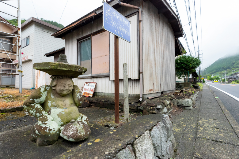
Passing through the strict checkpoint at the Suwa Guard Station after crossing the Katsura River from the Sagami Region, this is Uenohara-shuku, the first post station in the Kai Region. The area once flourished through sericulture and textile manufacture, and there were many merchants along the street that joined markets each month held on the days with the numbers of 1 and 6 in them. The area still bustles with people, and the aroma of steaming white buns with bean paste filling (Sake manju), retro restaurants, and stores welcome visitors. Even strolling along side roads parallel to the Chuo Expressway, visitors can feel the atmosphere of the olden days with views of the former Uenohara-jo Castle site before returning easily to JR Uenohara Station.
Distance : 9km / Required Time : 3~4h / walk,bicycle
Visiting the four post stations in Uenohara, Shimotorisawa-shuku, and Kamitorisawa-shuku: Retracing the history of post stations ②
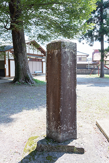
Following the old Koshu-kaido Road to Tsurukara-shuku via the Tsuru River. Most of the households in the village were engaged in the inn business, and traces can be seen along the road. Nodajiri-shuku, next to Tsurukawa-shuku, has retained the atmosphere of the old post station. Soon after the entrance to the post station, the road turns sharply to block visibility and provide an obstacle to prevent attacks by enemies. Inume-shuku is known in Ukiyoe, Japanese woodblock prints created by Katsushika Hokusai and Utagawa Hiroshige. It is the first place on the old Koshu-kaido Road after entering the Kai Region that provides a view of Mount Fuji. Shimotorisawa-shuku and Kamitorisawa-shuku are to the south. It’s fun to compare the atmosphere of each post station, check the milestones (Ichiri-zuka) and visit the old battlefields when strolling along the old Koshu-kaido Road.
Distance : 25km / Required Time : 7h / walk,bicycle,car
From Shiromotorisawa-shuku to Saruhashi-shuku: Walking along the road drawn in master paintings
Going beyond Inume-shuku, there is another post station that retains the atmosphere of the olden days. Shimorotisawa-shuku functioned jointly with the next station, Kamitorisawa-shuku. Kamitorisawa-shuku opened from the 1st to 15th of the month, and Shiromotorisawa-shuku opened from the 15th to the last day of the month. A short way from Kamitorisawa-shuku is Saruhashi Bridge. It is one of the three unique bridges in Japan. Well known as a scenic beauty from the olden days, its rare structure is supported by four-layered posts stretching out from both sides of the cliff, and it has no piers. It is featured in “A Painting of the Koyo Saruhashi Bridge” by Utagawa Hiroshige. Saruhashi-shuku is on the other side of Saruhashi Bridge. The landscape created by Saruhashi Bridge and the Katsura River are a treat for travelers passing along the road. Visitors enjoy the landscape along the walking path leading from Saruhashi Bridge. The Otsuki City Local Museum also shows the structure of Saruhashi Bridge, and the circumstances of post stations in the olden days.
Distance : 5km / Required Time : 4h / walk
Visiting three post stations in Sasago that jointly supported travelers
There are three small post stations, Shirano-shuku, Amidado-shuku, and Kuronoda-shuku, about 7 km before the Sasago Pass. These three post stations worked together by turns to serve travelers, a system called aishuku. These were small post stations, but each had its own main lodging (honjin). Visitors enjoy strolling in the quiet townscape along the old Koshu-kaido Road while finding stone monuments and standing quietly on the grounds of shrines. A puppet show called Sasago Oiwake Ningyo was performed for travelers preparing to cross the Sasago Pass, and the puppet show has been passed down to through the generations.
Distance : 10km / Required Time : 3~4h / walk
Walking beyond Sasago Pass, the most dangerous spot along the old Koshu-kaido Road
The path along the Sasago Pass rises to 1,096 meters above sea level and was extremely rough and steep. It was known as the most dangerous spot along the old Koshu-kaido Road. There is a tree known as the Yatate cedar on the way to the pass. Warriors heading to battle beyond the Sasago Pass shot arrows at the Yatate cedar as a prayer for victory. This magnificent tree attracted renowned Ukiyoe masters of the day, and many used it as a subject. The old Koshu-kaido Road, which goes over the Sasago Pass is included in the List of the 100 Best Historic Roads by the Agency for Cultural Affairs, and there are many items that retain the atmosphere of those days of old along the road. At Komakai-shuku and Tsuruse-shuku, visitors can see and feel the traces of old post stations while strolling.
Distance : 17km / Required Time : 6~7h / walk
Visiting Katsunuma-shuku filled with history and cultural landscapes with vineyard and water
Katsunuma-shuku developed as the gateway on the east side of the Koshu Basin. In “Diary of the Journey to Kyochu (Kyochu Kiko),” Ogyu Sorai describes Katsunuma-shuku as the busiest post station with many houses and bustling with travelers. A large flood caused significant damage to the Kyoto area in 1907, when rice paddies on the river terraces were swept away. The fields were restored, however, and farmers started growing grapes. These were valuable as a commercial crop. With the great combination of grape production and wine making, and the opening of railways and tourist farms, Katsunuma-shuku continued growing. Going toward the west from Daizen-ji Temple along the old Koshu-kaido Road, visitors enjoy a landscape from the olden days with historic buildings and vineyards, and the tourist farms are very popular. In the southern part of the post station near the Nikkawa River, there is a magnificent landscape with vineyards spreading over the area that support the history and culture of Katsunuma.
Distance : 4km / Required Time : 3~4h / walk
Visiting Kurihara-shuku to see peach fields and history
Kurihara-shuku once flourished under the rule of the Kurihara Clan, and many temples remain from that time. Many actors heading to Kofu for Kabuki performances used the old Koshu-kaido Road, which promoted the formation of Kabuki performed by local actors (mura-kabuki). Due to the damage by a large flood in 1907, the townscape of the old times no longer exists. However, the landscape with peach fields and temples has not changed from the olden days.
Distance : 3km / Required Time : 3h / walk, bicycle
Visiting Isawa-shuku, where tradition and life grow together with rivers
Isawa-shuku was at a junction of the Kamakura-kaido Road, stretching toward the south, and the road to Ichikawa (Ichikawa-michi) stretching toward the southwest. It also had a landing for access to Fujikawa river transport via the Fuefuki River, and functioned as a key point for transportation in the eastern part of the Koshu Basin. In the Edo Period, when the old Koshu-kaido Road was built, the center of politics and economy shifted to Kofu; however, the Hatta Family Shoin (drawing room) and many other historic buildings remaining from the early Edo Period evoke the atmosphere of the time. Because this area was located on the low land between the Fuefuki River and the Isawa River, it was repeatedly damaged by floods, and covered with earth and sand. The present-day Fuefuki River, which was called the Ukai River before being flooded many times, caused damage to people and changed the town significantly. The Fuefuki River was named after a tragedy caused by a flood. The tragedy and another story related in a Noh song called Ukai, meaning cormorant fishing, are interesting and worth learning about. A walking path along present-day Fuefuki River provides a distant view of a few beautifully formed alluvial fans created by river water flowing into the Kofu Basin, and the channels running through mountain ranges in the surrounding area.
Distance : 7km / Required Time : 3h / walk, bicycle
Visiting Kofu-Yanagimachi-shuku, which flourished with business and art
Kofu-Yanagimachi-shuku was built in the town around Kofu-jo Castle. This post station was always bustling with merchants, performers and artists such as Ichikawa Danjuro and Utagawa Hiroshige. Around this post station, there was a street along which many masters gathered and formed into districts such as Uo-machi (which means Fisherman Town), Okeya-machi (which means Wooden Bucket Merchant Town), and Kajiya-machi (which means Blacksmith Town), names that remain to this day. There are also some traces of moats and earthen walls that surrounded samurai residence areas and merchant areas seen in various locations. In this post station, local specialty products and food were produced. These included Inden products, which are made of lacquered deerskin and were loved by the stylish people in Edo, and boiled abalone in soy sauce-based sauce, a technique developed to preserve the abalone while it was transported such a long distance from the ocean, are still available at stores that were listed in the Kofu Kaimono Hitori Annai (Kofu Shopping Guide), an information magazine published in the Edo Period.
Distance : 4km / Required Time : 3h / walk, bicycle
時Visiting Nirasaki-juku, where the spirit of town development has been passed down over time
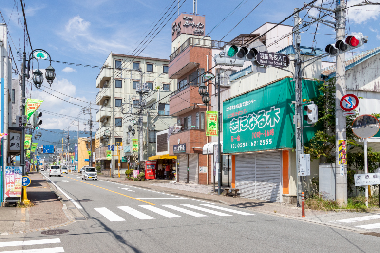
Nirasaki-shuku was an important point for transportation that was separated into Saku Okan (between Nirasaki-shuku and Iwamurada-shuku) and Sunshin Okan (Sunpu-Shinano Highway), and flourished as a post station bustling with pedestrian and horse traffic. The area around Kamanashi River landing, where goods were unloaded, was especially crowded with land transport services (chuma) using horses. Nirasaki-shuku was also affected by flooding of the Kamanashi River. There is a trace of an old embankment in an alley on the Kamanashi River side on the old Koshu-kaido Road, which can still be seen today. There are some side roads meandering along the river next to houses, and all of the side roads run toward the area of Shirahige-jinja Shrine, where Suijin (the god of water) remains as a place name. The town was divided into long and thin areas to avoid the house-frontage tax, and these districts remain to the present. Most of the properties on the present street running off of the old Koshu-kaido Road and Saku Okan Road are small and inexpensive. These have attracted young people wishing to start businesses. This was a hub for people, goods, and information filled with the spirit of business, a spirit that has been passed down to the present day and is continually being renewed. It still serves as a post station.
Distance : 3km / Required Time : 1.5h / walk
Visiting Daigahara-shuku, known for its white quartz sand and excellent natural water that retain the atmosphere of the olden days
Daigahara-shuku is located near the upstream of the point where the Kamanashi River and the Ojira River merge. It is an alluvial fan formed by accumulated white quartz sand carried by the Ojira River from Mount Kai-Komagatake. The land around the alluvial fan was formed into river terraces through erosion by the Kamanashi and Ojira Rivers. Water flowing from Mount Kai-Komagatake and purified by the bed of granite is suitable for rice and sake production. In addition to the Araotanaka-jinja Shrine and Tanaka-jinja Shrine, which were stopping-off points for processions from Kyoto bringing Uji tea that had been ordered each year by the Edo shogunate (ocha-tsubo dochu), and the Kitahara Family Residence, which served as Emperor Meiji’s accommodations (anzai-sho) when he visited Koshu, there are many town houses, storehouses, and other structures along the road that evoke the atmosphere of the olden days.
Distance : 6.5km / Required Time : 3.5h / walk