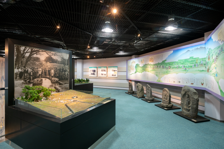
The road that traces history and culture developed in nature at the foot of Mt. Yatsugatake
The southern foot of Mt. Yatsugatake was where the Minamoto Family (Genji) lived in the Kai Region. The road called Bomichi that runs through the area was thought to have been developed by Takeda Shingen, a feudal lord known as a great commander. The road was key to the distribution of goods and the lives of the people in the region.
It also shows us the lives of samurai and others in the old days surrounded by a magnificent view of Mt. Yatsugatake, the Southern Alps, and Mt. Fuji.
It also shows us the lives of samurai and others in the old days surrounded by a magnificent view of Mt. Yatsugatake, the Southern Alps, and Mt. Fuji.
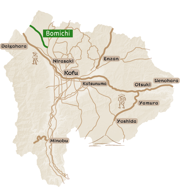
The Bomichi road started from southern foot of Mt. Yatsugatake and ran straight toward the Suwa area via the western foot of Mt. Yatsugatake.
This is the area where the Minamoto Family, a well-known clan in the Kai Region, rose to power. In the Heian Period (794-1185), at the foot of Mt. Yatsugatake, there was an imperial pasture called Mimaki where horses were raised for the Imperial Court. In the 12th century, Minamoto-no Kiyomitsu, the founder of the Kai-Minamoto Clan in the Kai Region, was exiled from the Hitachi Region (present-day Ibaraki Prefecture) to Ichikawa-no-sho with his father Yoshikiyo. Within the area they were exiled, they chose to live here because of the imperial pasture.
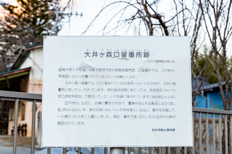
There are different ideas regarding the history of the Bomichi road. Some say that it was a military road developed by Takeda Shingen to facilitate the conquering of the northern Shinano area, and that the planned route running in a straight line on the southern foot of Mt. Yatsugatake made it the most direct route possible. This is said to be the origin of the name Bomichi, literally “bar-shaped road” in Japanese. Others say that the road was developed for the benefit of the residents of Hara Village (Suwa) and villages at the southern foot of Mt. Yatsugatake (around Yato-jo Castle and Nagasaka Station). The overall features of the road have not yet been clarified. According to the Records of the Kai Region, there were three routes, upper, middle, and lower; however, some say that there was only the upper Bomichi road. The prevailing opinion is that there was a route starting from Wakamiko (Hokuto City) to Daimon Pass (Kayano City/ Nagawa Town in Nagano Prefecture) via Tatsuzawa (Fujimi Town in Nagano Prefecture).
Walking along the Bomichi road, visitors see a dynamic landscape that includes Mt. Yatsugatake in the north, Mt. Kai-Komagatake, Mt. Kitadake, the three mountains of Ho-o in the west, and Mt. Fuji over the Kofu Basin in the south, views that have remained unchanged since ancient times. Forests, buckwheat fields, pastures, and water channels that remain to the present days warm our hearts. Contemplating the long history in the grand views during a relaxing stroll along Bomichi road is a charming experience.
This is the area where the Minamoto Family, a well-known clan in the Kai Region, rose to power. In the Heian Period (794-1185), at the foot of Mt. Yatsugatake, there was an imperial pasture called Mimaki where horses were raised for the Imperial Court. In the 12th century, Minamoto-no Kiyomitsu, the founder of the Kai-Minamoto Clan in the Kai Region, was exiled from the Hitachi Region (present-day Ibaraki Prefecture) to Ichikawa-no-sho with his father Yoshikiyo. Within the area they were exiled, they chose to live here because of the imperial pasture.
There are different ideas regarding the history of the Bomichi road. Some say that it was a military road developed by Takeda Shingen to facilitate the conquering of the northern Shinano area, and that the planned route running in a straight line on the southern foot of Mt. Yatsugatake made it the most direct route possible. This is said to be the origin of the name Bomichi, literally “bar-shaped road” in Japanese. Others say that the road was developed for the benefit of the residents of Hara Village (Suwa) and villages at the southern foot of Mt. Yatsugatake (around Yato-jo Castle and Nagasaka Station). The overall features of the road have not yet been clarified. According to the Records of the Kai Region, there were three routes, upper, middle, and lower; however, some say that there was only the upper Bomichi road. The prevailing opinion is that there was a route starting from Wakamiko (Hokuto City) to Daimon Pass (Kayano City/ Nagawa Town in Nagano Prefecture) via Tatsuzawa (Fujimi Town in Nagano Prefecture).
Walking along the Bomichi road, visitors see a dynamic landscape that includes Mt. Yatsugatake in the north, Mt. Kai-Komagatake, Mt. Kitadake, the three mountains of Ho-o in the west, and Mt. Fuji over the Kofu Basin in the south, views that have remained unchanged since ancient times. Forests, buckwheat fields, pastures, and water channels that remain to the present days warm our hearts. Contemplating the long history in the grand views during a relaxing stroll along Bomichi road is a charming experience.
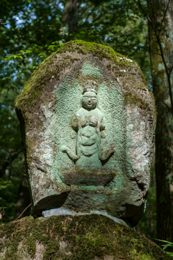
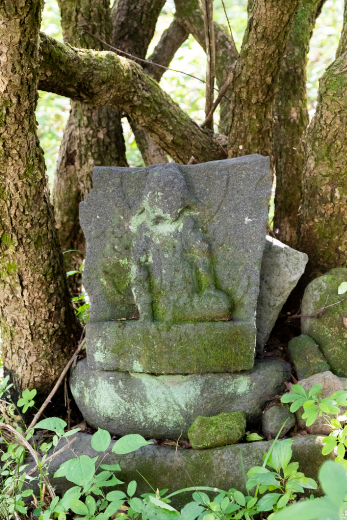
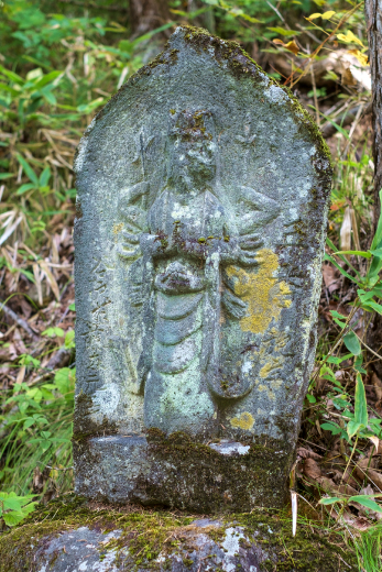
Visiting stone statues of Buddha along Bomichi road
Pilgrimage to the 33 Saigoku Kannon Sites & 33 Bando Kannon Sites
At the end of the Edo Period, people in Nagasaka Town and Oizumi Town in the present-day Hokuto City carried goods by horses to trade with Suwa Region. However, since Bomichi road toward Suwa had narrowed with time and people would often lose their way, local residents donated funds to create a path, placed stone statues of Buddha every cho (about 109 m) as signposts and to pray for the safety for travelers and merchants. Bomichi road has many sections that are no longer well defined; however, the sections with stone statues of Buddha remain.
From the watch tower to the stone Buddha at the 31st Saigoku Kannon, the road is unpaved and retains the atmosphere of the old road. It has been partially widened to create a firebreak; however, some sections remained as narrow as it was during the Edo Period (1603-1868), just wide enough for horses and people to squeeze past each other. Now surrounded by larch trees, it was a vast field where people grew grass for horse feed. Strolling along the old road and enjoying the traces of days gone by is an experience certain to last a lifetime.
From the watch tower to the stone Buddha at the 31st Saigoku Kannon, the road is unpaved and retains the atmosphere of the old road. It has been partially widened to create a firebreak; however, some sections remained as narrow as it was during the Edo Period (1603-1868), just wide enough for horses and people to squeeze past each other. Now surrounded by larch trees, it was a vast field where people grew grass for horse feed. Strolling along the old road and enjoying the traces of days gone by is an experience certain to last a lifetime.
Distance : About 8.2km / Required Time : About 4 Hours / On foot
Visiting spring water sites
The curse and blessing of water from Mount Yatsugatake
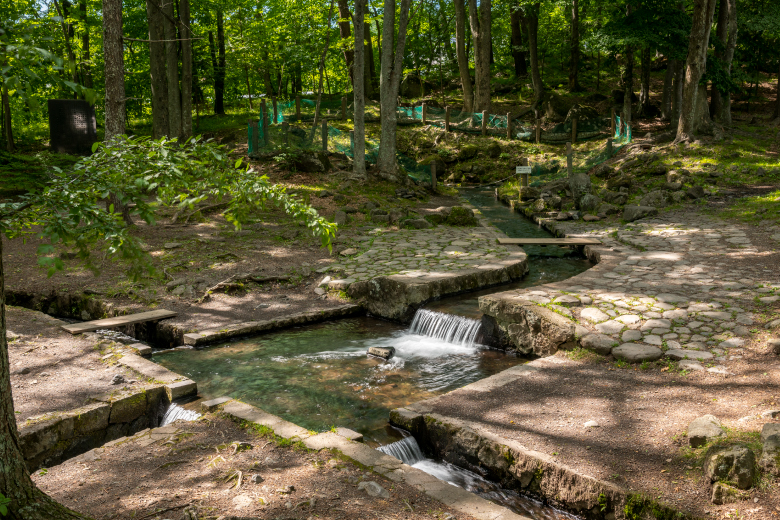
There are many springs at the foot of Mount Yatsugatake that served as precious sources of water for the people living in the area. Unfortunately, however, they also caused landslides, called On-dashi, that caused significant damage to the area. Around Bomichi road, springs, systems to share the spring water, and traces of landslides, including huge rocks, remain.
Distance : About 10km / Required Time : About 5 Hours / On foot
Strolling along a section of Bomichi road developed by Takeda Shingen
Strolling along a part of Bomichi road thought to have been developed by Takeda Shingen as a military road
There are many springs at the foot of Mount Yatsugatake that served as precious sources of water for the people living in the area. Unfortunately, however, they also caused landslides, called On-dashi, that caused significant damage to the area. Around Bomichi road, springs, systems to share the spring water, and traces of landslides, including huge rocks, remain.
Distance : About 8.5km / Required Time : About 4.5 Hours / On foot
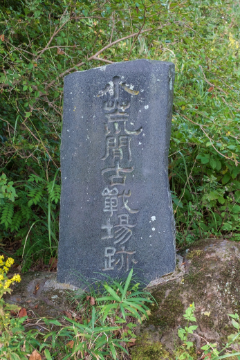
Visiting the legendary sites of Takeda Shingen
Tracing the affection and respect of residents for Takeda Shingen
There are many springs at the foot of Mount Yatsugatake that served as precious sources of water for the people living in the area. Unfortunately, however, they also caused landslides, called On-dashi, that caused significant damage to the area. Around Bomichi road, springs, systems to share the spring water, and traces of landslides, including huge rocks, remain.
Distance : About 11km / Required Time : About 5 Hours / On foot
Tracing the historic sites related to the Kai-Minamoto Clan in the Kai Region
Enjoy the magnificent landscape while visiting the former site of a castle, temples and shrines deeply associated with the Kai-Minamoto Clan
Around the 12th century, Minamoto Kiyomitsu, founder of the Kai-Minamoto Clan in the Kai Region, moved into Hemi (thought to have been around Yato-jo Castle and Wakamiko-jo Castle) at the south foot of the Mount Yatsugatake, and took “Hemi” as his family name. Geographically, the south foot of the Mount Yatsugatake was suitable for raising horses, which was what it was selected as an Imperial pasture (Mimaki). The Kai-Minamoto Clan built a strong military force with cavalry. Trees cut down to clear the imperial pasture were used for lumber or fuel for forges used to make swords. Such environmental factors were thought to have led to the rapid progress of the Kai-Minamoto Clan, which would expand to present-day Yamanashi Prefecture and nationwide.
Hemi was ruled by the Hemi Clan, etc. after the death of Minamoto (Hemi) Kiyomitsu. In the 15th century, it was ruled by the Imai Clan, and in the 16th century, it was ruled by Takeda Clan. All of the clans were branches of the Kai-Minamoto Clan.
Along the Bomichi road are places with deep connections to the former site of a castle associated with the Kai-Minamoto Clan, and the temples and shrines where they worshipped. The Kofu Basin with Mount Yatsugatake in the background offers a magnificent view with Mount Fuji to the front, and the Southern Alps on the right. Surrounded by the grand view that the Kai-Minamoto Clan must have seen, we will head down to the Kofu Basin.
Distance : About 11km / Required Time : About 5.5 Hours / On foot
Visiting the birthplace of the Takeda Clan
Visiting sites related to Takeda Nobuyoshi, the founder of Takeda Clan
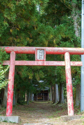
Minamoto-no Kiyomitsu, founder of Kai-Minamoto Clan in the Kai Region lived at the southern foot of Mount Yatsugatake and was blessed with male children. They lived in different areas of present-day Yamanashi Prefecture and expanded the clan’s power. The coming of age (genpuku) ceremony of one of the children, Nobuyoshi, took place at Takeda Hachiman-gu Shrine in Takeda (present-day Kamiyama Town in Nirasaki City) located to the south of Hemi. He took the name Takeda, and this marked the beginning of the Takeda Clan, which went on to become a distinguished family and produce Takeda Shingen.
Takeda Nobuyoshi played an active role in the Genpei War, and once served as a commander of samurai along with Minamoto-no Yoritomo and Yoshinaka. However, as Yoritomo sought to consolidate his power, he concluded that the Kai-Minamoto Clan was too independent to control, and decided to eliminate them. Ichijo Tadayori was killed, and Takeda Nobuyoshi resigned his position. Perhaps due to Nobuyoshi’s loss of power, the temple that takes care of Takeda Hachiman-gu Shrine, where Nobuyoshi’s genpuku took place, was not Ganjo-ji Temple, which was located nearby and deeply related to Nobuyoshi, but Hozen-ji Temple (Minami-Alps City), which was restored by Kagami Tomitsu, who was Nobuyoshi’s brother and who received favorable treatment from Minamoto-no Yoritomo.
In Kamiyama Town, Nirasaki City where Takeda Clan started, there are many historic sites related to Takeda Clan such as ruins of a castle, residence, temples and shrines where Nobuyoshi worshipped. Although they are away from the Bomichi road, these historic sites tell stories that connect the Kai-Minamoto Clan with the Takeda Clan. The landscape with Mount Yatsugatake to the north, Mount Kayagatake to the east, the Chichibu Mountain Range beyond, and Mount Fuji to the southeast.
Distance : About 9km / Required Time : About 4 Hours / On foot