The road to trace samurai culture in Kai Region
Chichibu Okan road is a mountain pass with fog, clouds and mist held by scenic sites full of nature. Along the pass, we see the traces of Takeda Clan (Genji) in the Kai Region and history and culture supported and passed down by those samurai.
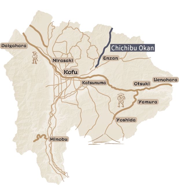
The Chichibu Okan Road is a historic road connecting the Kai Region and the Musashi Region, which are present-day Yamanashi Prefecture and Chichibu City, Saitama Prefecture. Since it is on the border of two prefectures and beyond the Karisaka Pass, it was also called Karisaka-guchi or Karisaka-ji. Chichibu Okan and National Route 140 overlap, and it is easy to find national routes signs with “Karisaka-michi.” From the three-way intersection at Yamasaki, which is the starting point in Kofu City, to Kobaranishi intersection in Yamanashi City and the Oume-kaido Road overlap. The Chichibu Okan Road continues gently skirts the mountains until Fuefuki City. After entering Yamanashi City, the road runs north along the Fuefuki River, increasing in elevation toward the massif of the Oku-chichibu Mountains. The highest point, the Karisaka Pass, was known as a dangerous spot described as having no houses about 30 km above and below the pass, and a section where cows and horses could not pass because the road was very rough and narrow.
According to a legend, in olden times, Yamato-Takeru-no-Mikoto followed this road from Sakaorimiya on his expedition to the east toward Chichibu. In the medieval period, the road enabled military functions such as the placement of a fire beacon platforms for communication along the road. In and after the modern period, people and goods moved along the road. It was also used to visit Mitsumine-jinja Shrine and Chichibu Kannnon Reijo from the Kai Region, and Mt. Minobu, Mt. Fuji, and Ise from Chichibu for religious purposes. Around the Chichibu Okan Road that connected the flatlands and mountains, and there remains a wide range of traces from the past, treating visitors to the area’s deep nature and long history.
According to a legend, in olden times, Yamato-Takeru-no-Mikoto followed this road from Sakaorimiya on his expedition to the east toward Chichibu. In the medieval period, the road enabled military functions such as the placement of a fire beacon platforms for communication along the road. In and after the modern period, people and goods moved along the road. It was also used to visit Mitsumine-jinja Shrine and Chichibu Kannnon Reijo from the Kai Region, and Mt. Minobu, Mt. Fuji, and Ise from Chichibu for religious purposes. Around the Chichibu Okan Road that connected the flatlands and mountains, and there remains a wide range of traces from the past, treating visitors to the area’s deep nature and long history.
The road for the Takeda Clan, descended from Takeda Nobutoki, to Fuchu in Kai Region
Tracing the history of the Takeda Clan running through the Kai Region for 300 years until Takeda Shingen
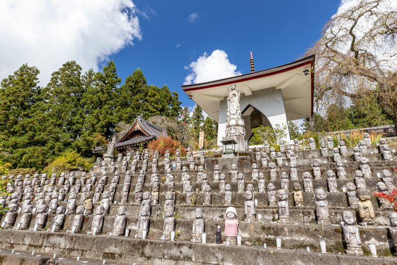
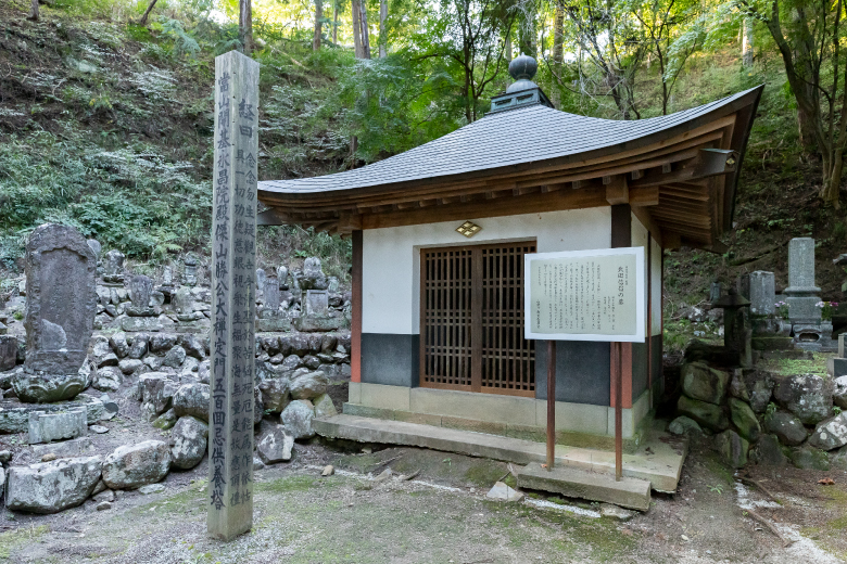
The direct ancestor of Takeda Shingen, the Governor of the Kai Region, was Takeda Nobutoki, 7th lord of the Takeda Clan in the Kai Region (1220-1289), which is also called Nobutoki-ryu (The Takeda Clan descended from Takeda Nobutoki). There are many spots deeply associated with the branch of the Takeda Clan descended from Takeda Nobutoki along the Chichibu Okan Road, which allows us to trace the generations of the family from Nobutora to Shingen, and then to Katsuyori.
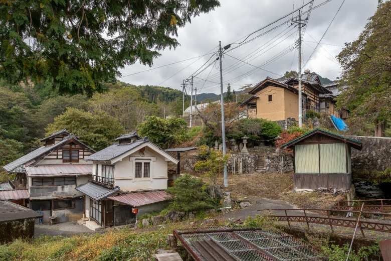
A wide variety of cultural and historical traces left by warriors serving the lords of the Takeda Clan, who were the rulers with force of arms and power, and practitioners of the religious faith, remain in the area. Former sites of temples and residences deeply associated with the Takeda Clan show that they worked largely in present-day Yamanashi City, Koshu City, Fuefuki City, and Kofu City. The center of the activity gradually shifted west along with the expansion of their power over time. Chichibu Okan Road is a road to history running east-west through this area connecting the traces of the clan over time.
A wide variety of cultural and historical traces left by warriors serving the lords of the Takeda Clan, who were the rulers with force of arms and power, and practitioners of the religious faith, remain in the area. Former sites of temples and residences deeply associated with the Takeda Clan show that they worked largely in present-day Yamanashi City, Koshu City, Fuefuki City, and Kofu City. The center of the activity gradually shifted west along with the expansion of their power over time. Chichibu Okan Road is a road to history running east-west through this area connecting the traces of the clan over time.
Distance : about 40 km / Required Time : about 7.0 hours / Car
A junction: Hagiwara to the right and Yahata to the left
From Isawa to Kasugai – Heading to the town named after a road
At a three-way intersection (present-day Yanagibashi Intersection) at Betsuden in Fuefuki City, a stone tower of all souls in the three realms of existence (San-kai-ban-rei-to) remains. “The right road leads to Hagiwara, and the left road leads to Yahata” is engraved on the tower. Hagiwara Road (Hagiwara-michi) is another name for Ome-kaido Road, which passes Hagiwara on the way to Daibosatsu Pass, and Yahata Road (Yahata-michi) is another name for Chichibu Okan Road, which passes the former Yahata Village, showing that this is the junction of the Chichibu Okan Main Road (parallel to Ome-kaido Road) and the side road.
According to the “Kai-Koku-Shi” (Records of the Kai Region) edited at the end of the Edo Period, Betsuden (separate paddy) was named because there was a junction. Around Betsuden, initially the name of the road, many signposts and travelers’ guardian deity statues remain. Temples along the roads at the foot of the mountain and key points for transportation in old days are interesting spots to visit. Peach blossoms in the area provide a wonderful landscape in spring. Along the way, Iwashita Onsen has hot springs for day trippers, and a foot bath is also available at the Isawa-Onsen Station located at the end of this road.
According to the “Kai-Koku-Shi” (Records of the Kai Region) edited at the end of the Edo Period, Betsuden (separate paddy) was named because there was a junction. Around Betsuden, initially the name of the road, many signposts and travelers’ guardian deity statues remain. Temples along the roads at the foot of the mountain and key points for transportation in old days are interesting spots to visit. Peach blossoms in the area provide a wonderful landscape in spring. Along the way, Iwashita Onsen has hot springs for day trippers, and a foot bath is also available at the Isawa-Onsen Station located at the end of this road.
Distance : 11.5 km(Bicycle Course)
8.3 km(Walking Course) / Required Time : about 6.0 hours by bicycle /
about 7.0 hours on foot / Bicycle or Walk
Visiting the Enzan-Matsusato area - The water channel that developed the historic road
Tracing culture and lifestyles supported by the water, and the wisdom of making water channels to supply water from the Fuefuki River
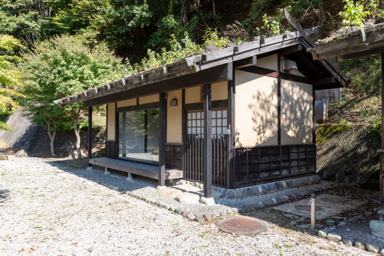
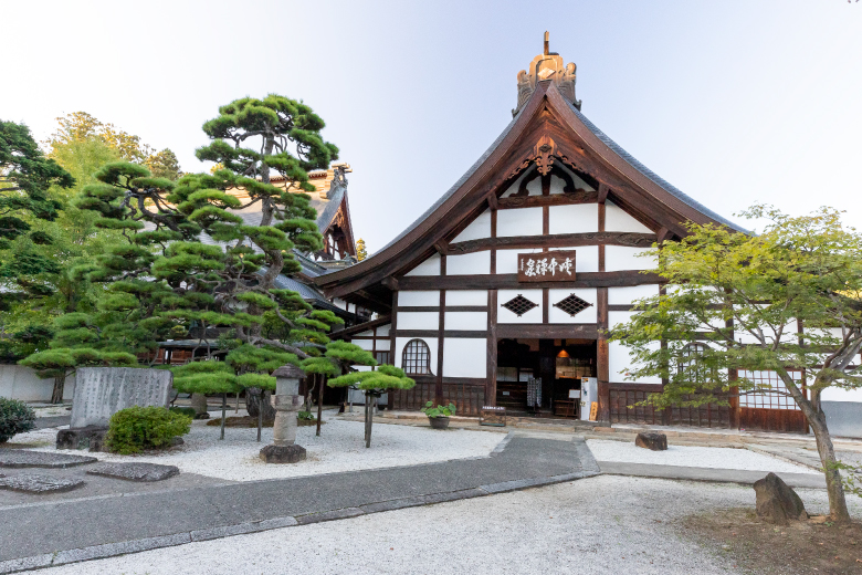
Erin-ji Temple Garden is a national-designated site of scenic beauty built by Zen monk Muso Soseki at the age of 56. Muso Soseki is well known for creating the Ryuan-ji Temple Garden and Seiho-ji Temple (Kokedera) Garden. He had significant influence on temple garden designs in the Kai Region. The magnificent artificial mountains and ponds that have remained over 700 years feature the attractions of each season. In Koshu Region, water channels are called segi, and three water channels (Fujiki, Koyashiki, and Ijiri Segi) from the Fuefuki River run in all directions in the Enzan Area to supply water to the river terraces. The water used for the garden at Erin-ji Temple is also from Koyashiki Segi.
The water channels form a network of straight lines in the Enzan Area, and is the basic feature of the landscape of farms on both sides of the water channel. The water not only supported life and business, but also functioned as the foundation of culture seen at temples and shrines, culture such as the gardens.
The water channels form a network of straight lines in the Enzan Area, and is the basic feature of the landscape of farms on both sides of the water channel. The water not only supported life and business, but also functioned as the foundation of culture seen at temples and shrines, culture such as the gardens.
Distance : 13.0 km / Required Time : about 7.0 hours / Bicycle
Tracing the backroads of Chichibu and the footsteps of Muso Soseki
A Buddhist priest skilled in garden design (Ishitate-so) – The perspective of Muso Soseki: Stepping deeply into mist along the old road
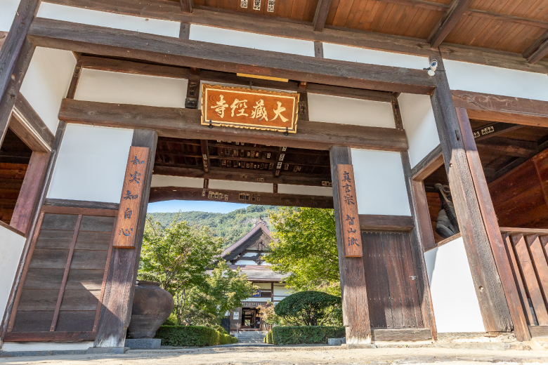
Deeply intertwined with the history of medieval Japan, Muso Soseki was a Zen monk of the Rinzai Sect who served the Ashikaga shogunate as an advisor during the Muromachi Period (1336-1573). He spent his childhood and trained to become a Buddhist priest in the Kai Region. Kentokusan (Mount Kentoku) was the mountain name (sango) of Erin-ji Temple, where Muso Soseki served as priest. The springs called Ginsho-sui and Kinsho-sui, and a rock for medication (Zazen-seki) remain and can be found on the mountain. Joko-ji Temple, which was located in Makioka Town, Yamanashi Prefecture, is thought to have been established by Muso Soseki after he completed his training.
Besides these, there are many traces of Muso Soseki along the Chichibu Okan Road and in the surrounding areas. It is said that Muso Soseki had as many as 10,000 disciples, and that he was given posthumous Buddhist names by seven emperors and former emperors. Muso Soseki was also skilled in garden design (Ishitate-so). Describing himself as a lover of nature, he had a special fondness for the beauty of fog, cloud, and mist. His aesthetic may have developed as he grew up and trained surrounded by the mountains and fields of the Kai Region.
This route brings visitors to temples that show traces of Muso Soseki, spots related to the Kai-Minamoto Clan and Yasuda Yoshisada, and to the backroads in Chichibu.
Distance : about 40 km / Required Time : about 6.0 hours / Car
Tracing the major sites on Chichibu Okan Road
Climbing to a mountain pass toward the Oku-chichibu Mountain Range along the Fuefuki River
This route starts from the three-way intersection at Yamasaki in Kofu City and ends at the entrance of the Karisaka Tunnel located on the border of the prefecture. It rises approximately 1,000 meters and runs through the Chichibu Okan Road in Yamanashi Prefecture.
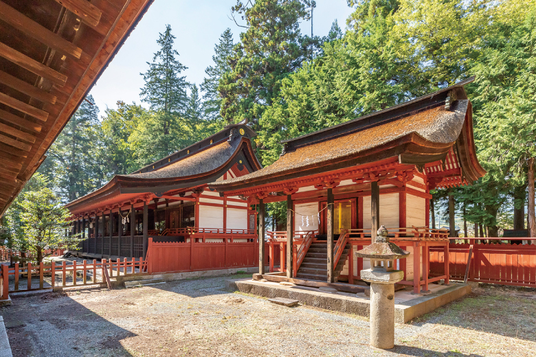
There are many historically interesting and significant spots along the road. In the northern mountainous area from Ichinohashi in Yamanashi City, visitors can discover the true nature of Chichibu Okan Road surrounded by affluent water and greenery such as the magnificent Ichinokama Waterfalls, Daitakesan Nagato-jinja Shrine situated deep in the mountains, and Kichijo-ji Temple with a sculpture related to the messengers for Takeda Shingen. It is also possible to trek at Tokuwa Valley and Nishizawa Valley, and hike up Mount Kentoku, Mount Kobushigatake, Mount Tosaka and Mount Karisaka.
This route is long and hard to complete within a day. Please consider staying overnight along the route at Isawa Onsen, Enzan Onsen, Iwashita Onsen, or Kawaura Onsen. We also recommend limiting the number of sites that you would like to visit.
Distance : about 60 km / Required Time : 1 day or more / Car