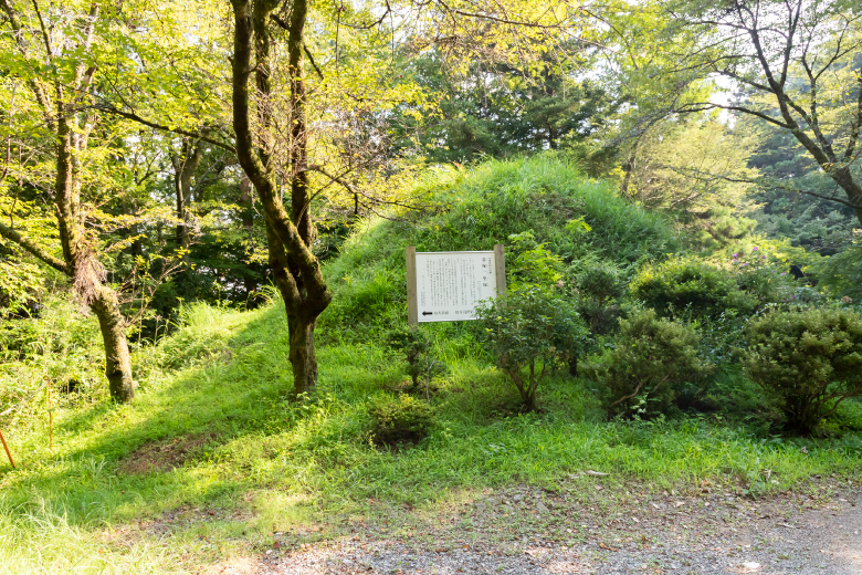
Ichiri-zuka are milestones placed every four kilometers (ichiri) along the Go-Kaido Roads (Five Highways) starting from Nihombashi. They were created during the Tokugawa Shogunate by building up mounds of earth on both sides of the road. They allowed travelers to keep track of distance, and were used in the calculation of standard wages for laborers or hired horses.
The 21st ichiri-zuka is located between Inume-shuku and Shimotorisawa-shuku, counting from Nihombashi. Using the original geographical features, a slightly elevated part was used as a mound.
The mound that was on the north side no longer remains; but on the south side, a mound measuring about 12 m in diameter and 5 m high remains as a complete feature. The only remaining ichiri-zuka in the Koshu Region with its complete original feature, it is designated as a Yamanashi Prefecture Cultural Property. The previous ichiri-zuka is located in Ogino.
